Land boundary disputes can be complex legal matters. They require precise measurements, historical analysis, and expert interpretation. In such cases, a surveying expert plays a crucial role in providing objective, technical insights to resolve conflicts.
This article explores the responsibilities of a surveying expert in a land boundary case. We’ll outline their role in research, fieldwork, legal proceedings, and resolution.
What is a land boundary dispute
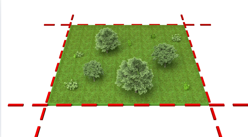
Understanding Land Boundary Disputes. Land boundary disputes arise when property owners disagree over the legal limits of their land. These conflicts may stem from unclear or outdated land records, encroachments, or misinterpretations of property descriptions. Disputes can involve individuals, corporations, or government entities and often require legal intervention to establish the correct boundaries.
In many cases, these disputes result from:
- Outdated or inaccurate property surveys that no longer represent the true boundary layout.
- Unclear or incomplete legal descriptions within property deeds that leave room for interpretation.
- Encroachments, where structures or improvements extend beyond one’s legal property line onto a neighboring property.
- Land use changes or development projects that disrupt established boundaries or create new confusion.
- Misinterpretation of boundary markers or monuments that can lead to incorrect assumptions about where property lines lie.

Other Types of Property Disputes
While land boundary disputes are among the most common, other conflicts can also arise. These include land use, ownership rights, or shared property arrangements. Some of the most frequent types of property disputes include:
- Easement disputes: Occur when one party believes they have a legal right to use a portion of another person’s land, often for access roads, utility lines, or drainage.
- Adverse possession claims: Arise when someone attempts to gain legal ownership of the land they have openly and continuously used without the permission of the original owner.
- Encroachment issues: Involve the unintentional or unauthorized use of a neighbor’s property, such as a fence, shed, or driveway crossing a property boundary line.
- Easement misuse or overuse: Disagreements may surface when an easement holder exceeds the scope of their rights, potentially impacting the property owner’s use.
- Disputes in shared or multi-unit properties: These may involve common area use, maintenance responsibilities, or property access in condominiums or housing developments.
- Zoning and land use conflicts: This happens when property development or use goes against local regulations or affects neighboring properties.
Surveying experts can play a valuable role in these cases by identifying precise boundaries. They also help in interpreting legal land descriptions and clarifying who has the right to use certain areas.
Surveying Experts and a Land Boundary Dispute Case
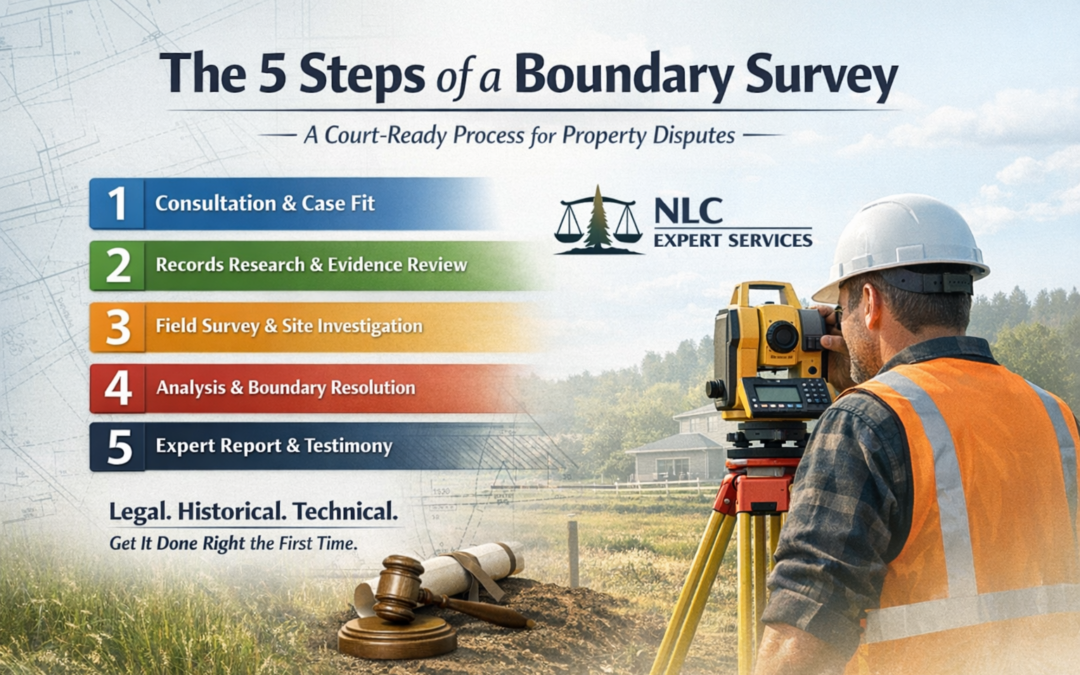
1. Role of a Surveying Expert
A surveying expert is a licensed professional with specialized knowledge in land measurement, mapping, and legal land descriptions. Their role in a land boundary case includes:
A. Research and Document Analysis
- Examining historical land deeds, surveys, and legal descriptions to understand the original boundaries.
- Reviewing title documents, easements, and agreements that might affect property boundaries.
- Investigating previous surveys to identify discrepancies or changes in land descriptions over time.
In many cases of property line disputes, this phase helps clarify the original intent of a boundary. Specifically, how it may have shifted over time due to human error, outdated mapping practices, or undocumented agreements.
Surveyors are also familiar with local and state regulations that govern how a legal boundary is interpreted when documentation is incomplete or unclear. This makes their role in land records analysis a critical first step in resolving disputes before legal escalation.
B. Conducting Field Surveys
- Using modern surveying equipment such as GPS, total stations, and drones to measure land accurately.
- Establishing boundary lines based on legal descriptions and physical markers.
- Identifying natural and artificial boundary markers, such as fences, walls, rivers, or roads.
- Comparing field data with historical records to verify accuracy.
During this phase, a new land survey may be conducted or updated to reflect the most current measurements. This process is not only technical but often investigative. It requires the expert to physically locate, reestablish, or legally re-mark boundaries.
C. Preparing Survey Reports and Maps
- Creating detailed boundary maps showing the precise measurements and legal boundaries.
- Documenting discrepancies, encroachments, or conflicts between historical records and current findings.
- Providing written reports summarizing findings, methodologies, and conclusions.
These documents often serve as key evidence in court proceedings. This is especially true when property line disputes arise from encroachments like fences or buildings extending beyond boundaries.
In addition to maps, these reports often contain photographic documentation and expert commentary that explain the significance of field findings.
2. Providing Expert Testimony in Legal Proceedings
When a boundary dispute escalates to court, a surveying expert may serve as an expert witness. Their responsibilities include:
- Explaining complex surveying principles and findings in a clear, understandable manner.
- Presenting survey reports, maps, affidavits, and historical records as evidence.
- Defending their methodologies and conclusions against cross-examination.
- Assisting attorneys in formulating legal arguments based on factual land data.
3. Encroachment Identification and Mitigation
When a structure crosses a property boundary, it’s considered an encroachment—and a common trigger for land boundary disputes. Surveying experts help identify and resolve these issues before they escalate into legal battles.
- Performing boundary surveys and field measurements to confirm encroachments.
- Documenting structures such as fences, sheds, or driveways that extend over legal boundaries.
- Advising property owners on mitigation options:
- Removing or relocating encroaching structures.
- Negotiating boundary adjustments or agreements.
- Providing expert input for legal documentation or settlement.
4. Adverse Possession and Prescriptive Easements
Some land boundary disputes stem from long-term use or occupation of land by someone other than the legal owner. In these cases, surveyors help assess whether legal doctrines like adverse possession or prescriptive easements apply.
Surveying experts contribute by:
- Analyzing historical usage records and physical site conditions.
- Identifying signs of continuous, unauthorized use (adverse possession).
- Reviewing access patterns and usage history to assess prescriptive easements.
- Producing reports to support or refute legal claims in court or negotiations.
5. Resolving Boundary Disputes
Surveying experts play a key role in resolving disputes through:
Mediation and Negotiation: Working with disputing parties to reach an amicable settlement based on objective survey data.
Administrative Resolution: Assisting government agencies in resolving boundary issues related to zoning, land use, or public projects.
Legal Remedies: Supporting litigation efforts when negotiations fail, ensuring that the court receives accurate and reliable boundary information.
Surveyors often serve as neutral third parties. They help both property owners understand how a land survey supports or disputes their claims. In high-stakes property line disputes, their involvement may also help prevent future legal conflicts by reestablishing permanent, documented markers for all parties.
6. Importance of Accuracy and Ethical Considerations
Surveying experts must adhere to strict ethical and professional standards, including:
- Maintaining impartiality and objectivity in their findings.
- Ensuring precision in measurements and documentation.
- Complying with local and national surveying laws and regulations.
A professional land surveyor is also responsible for maintaining compliance with professional codes set by state boards and national organizations. They must stay informed of regulatory changes to make sure their surveys meet legal admissibility standards.
Ethical surveying involves transparent communication with clients and stakeholders, especially in cases with potential legal consequences.
In land boundary cases, a surveying expert provides critical expertise. They help determine property lines accurately and resolve disputes efficiently. Through extensive research, precise fieldwork, and expert testimony, they ensure that legal decisions are based on factual, reliable data. Their role clarifies property boundaries and contributes to fair and just resolutions in property-related conflicts.
Need an Expert for your land boundary case? Contact us today!

0 Comments