Laser Scanning in Surveying Disputes
What is LiDAR Scanning?
LiDAR, which stands for Light Detection and Ranging, is a remote sensing technology that uses laser pulses to measure distances and create highly detailed 3D maps of the environment.
A LiDAR scanner emits rapid pulses of laser light and measures the time it takes for the light to bounce back after hitting objects in its path.
By analyzing the return time and intensity of the reflected light, LiDAR systems can accurately calculate the distance to each object, creating a precise point cloud representation of the scanned area.
Precision Measurements in Construction Surveying
Design-build professionals create (design) construction drawing and then land surveyors are expected to put the structures, bridges, and other man-made objects on-the-ground. But sometimes the as-built objects do not meet the design tolerances.
LiDAR scanning is able to capture the locations of these as-built structures within millimeters. Then, the design location can be compared with the as-built location to determine what errors if any exist in the size, shape, or location of the constructed objects.
NLC’s laser scanners also take pictures of any scanned objects to better visualize the project site.
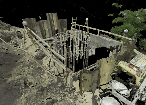
Image1
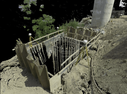
Image2
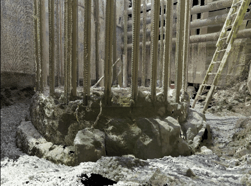
Image3
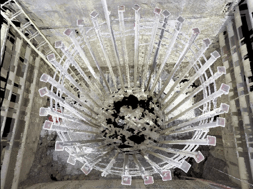
Image4
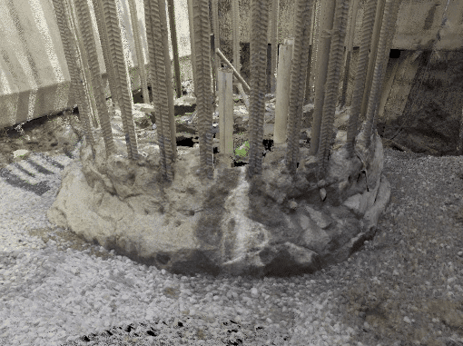
Image5
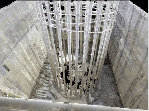
Image6
Visualizing The World for Courtroom Exhibits
In two decades of practice, I have never had a judge or jury travel to the project site at the center of a surveying dispute.
But instead of taking the “decider” to the land, we can bring a three-dimensional world inside the courtroom.
LiDAR scanning is so detailed that we can “fly through” any scanned site, just like a bird. We can also measure objects and take video captures to use as exhibits in expert reports or during testimony.