
Water is one of Texas’s most vital yet contentious resources. Currently, the state is grappling with rapid population growth, extended droughts, and increasing demands from agriculture, industry, and municipalities. Because of this, water use and Texas water rights have become a central concern in environmental and legal discourse.
In this complex landscape, surveyor experts play a crucial, often underappreciated role. They clarify boundaries, map water source access, and resolve disputes.
Overview of Water Rights in Texas
Texas water law is a blend of statutes, common law doctrines, and administrative regulations. It recognizes two broad categories of water: surface water and groundwater. Each is governed by different principles, agencies, and legal precedents outlined in the Texas Water Code.
Surface Water Rights
Surface water in Texas is owned by the state and regulated by the Texas Commission on Environmental Quality (TCEQ). These are defined as water in rivers, lakes, streams, and other naturally flowing bodies.. The state allocates the use of this water supply through a permitting system based on the prior appropriation doctrine: “first in time, first in right.”
Under this doctrine, those with earlier water rights (senior rights holders) are entitled to fulfill their water needs before junior rights holders. Surface water use requires a permit from the TCEQ, except in limited circumstances such as domestic and livestock use from an adjacent water source.
Groundwater Rights
Texas groundwater, by contrast, is governed by the rule of capture. This is a doctrine that allows landowners to pump and use groundwater from beneath their property without liability to neighboring landowners—even if it depletes their supply. This system is tempered in certain areas by Groundwater Conservation Districts (GCDs). They regulate pumping to prevent overuse and protect long-term water resource availability.
Texas’s dual legal framework comprises state-regulated surface water and privately governed groundwater. This creates a uniquely fragmented system with significant implications for landowners, developers, and resource planners.

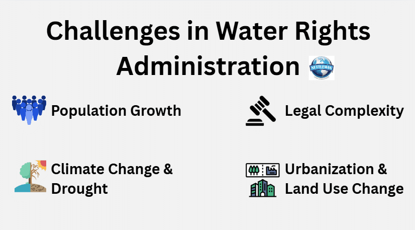
Challenges in Water Rights Administration
Water conservation and rights in Texas face increasing pressure from several forces:
- Population Growth: Texas is one of the fastest-growing states in the U.S., with over 30 million residents and counting. More people mean higher demand for drinking water, sanitation, agriculture, and industrial use.
- Climate Change and Drought: Extended periods of drought strain water supplies, especially in arid regions like West Texas. Climate variability is expected to intensify, making water management more unpredictable.
- Urbanization and Land Use Change: Expansion of cities and suburbs can disrupt traditional water access and alter watershed hydrology, leading to new disputes over water availability and drainage rights.
- Legal Complexity: With overlapping jurisdictions, permits, and rights, water law in Texas is difficult for the average landowner or developer to navigate without expert help.
Special Considerations for River, Lake, and Creek Boundaries
Water features don’t always stay still. Surveyors must evaluate how natural changes to watercourses affect property lines:
- Accretion refers to gradual land buildup along a waterway, which can shift ownership.
- Reliction involves water receding and exposing new land, possibly changing boundaries.
- Avulsion is a sudden change (like a flood) that doesn’t legally alter boundaries.
This is where professional surveyors step in. They help determine if the water body is navigable (state-owned) or not, which significantly affects the management and enforcement of water rights.
Role of Surveyor Experts in Water Rights
Professional surveyors play a critical role in a variety of water rights-related contexts. In particular, those licensed as Registered Professional Land Surveyors (RPLS) in Texas provide support in::
1. Defining Property Boundaries and Riparian Rights
Riparian rights refer to the rights of landowners whose property borders a natural watercourse. These rights are often tied to land ownership and can include access to water supply for domestic use, livestock, and irrigation.
Surveyors help define these rights by:
- Establishing precise boundary lines between private land and public water.
- Determining the “gradient boundary” for navigable rivers in Texas, which separates state-owned beds from private lands.
- Providing documentation that supports claims to riparian water rights, especially in the absence of formal deeds or permits.
2. Identifying Water Features and Usage Patterns
Surveyors use aerial imagery, GIS technology, and on-the-ground inspection to identify:
- The course of streams, rivers, and other water bodies.
- Man-made structures such as dams, levees, canals, and retention ponds.
- Historical and seasonal changes in water flow or boundaries.
This data is essential in disputes over surface water access. For instance, when an upstream user diverts or impounds water to the detriment of a downstream neighbor.
3. Supporting Permitting and Regulatory Compliance
Landowners or developers seeking to use surface water must often submit maps and technical data to the TCEQ as part of their permit application. Surveyors assist by:
- Creating site plans that show water sources, usage zones, and environmental impact buffers.
- Certifying distances to nearby water bodies or jurisdictional boundaries.
- Providing elevation data needed to demonstrate floodplain impacts or reservoir storage capacity.
4. Groundwater Well Placement and Spacing
In areas regulated by Groundwater Conservation Districts, well spacing rules may restrict how close wells can be placed to property lines or existing wells. Surveyors provide:
- Accurate measurement of well sites in compliance with district rules.
- Documentation for exemptions or variances.
- Expert testimony in administrative hearings where well placement is disputed.
5. Litigation Support and Expert Witness Services
Water rights disputes are common in Texas. This is particularly the case when surface water is over-allocated or groundwater pumping causes environmental damage. Surveyors often serve as expert witnesses in:
- Boundary disputes over water features.
- Claims of illegal diversion or overuse.
- Cases involving flood damage or drainage violations.
Their surveys, maps, and field notes can be introduced as evidence in court. Similarly, their professional judgment can carry significant weight in legal proceedings.

Case Study: A Boundary Dispute Along the Brazos River
Consider a hypothetical example: Two ranchers own adjacent tracts of land along the Brazos River. One installs a pump and diverts water for irrigation. The other claims this is encroaching on his riparian rights. A licensed surveyor is hired to:
- Map the river’s current and historical course.
- Determine if the watercourse is navigable (and therefore state-owned).
- Establish where the boundary between the ranchers lies.
Based on these findings, legal counsel is able to present a clear picture to the court, which rules on the validity and extent of each rancher’s rights. Without a surveyor’s expertise, such a case would be mired in conflicting anecdotal accounts and outdated maps.
Evolving Tools and Technologies
Surveying has come a long way from chains and compasses. Modern surveyors use:
- Drones and UAVs for aerial mapping of drainage patterns and large water bodies, like a river basin.
- LiDAR and photogrammetry for detailed elevation and topographical data.
- GIS platforms for integrating land, water, ownership, and regulatory data into interactive maps.
These technologies improve accuracy and allow for better communication with engineers, regulators, and the public.
The Future of Water Management in Texas
As Texas confronts a future of water scarcity, the integration of legal, scientific, and technical expertise will be critical. Surveyors stand at the intersection of land and water. They’ll be instrumental in providing the factual backbone for smart water governance. Their work informs:
- Regional water planning.
- Infrastructure development (dams, pipelines, treatment plants).
- Conservation strategies and ecological restoration.
As digital records and mapping become the norm, surveyors will be central to updating and maintaining accurate representations of land and water resources.
Water rights in Texas are defined by a complex patchwork of doctrines, laws, and local rules. As the state faces rising demand, dwindling supply, and growing legal disputes, professional surveyors offer vital skills to ensure fair, lawful, and efficient use of water. From defining boundaries and documenting usage to supporting litigation and compliance, their role is indispensable in upholding water rights across Texas.
As water becomes ever more valuable, the expertise of land surveyors will only become more critical—not just in resolving disputes, but in planning for a future where every drop counts!