
Field survey preparation is essential to ensure the accuracy, efficiency, and success of the survey. One critical aspect of this preparation is conducting a comprehensive search for land and property records. These records provide valuable historical, legal, and contextual information about the survey area, which can significantly influence the survey’s outcome. In this article, we will explore the various types of land and property records that researchers and surveyors might encounter during the preparation phase of a field survey.
What is a Field Survey
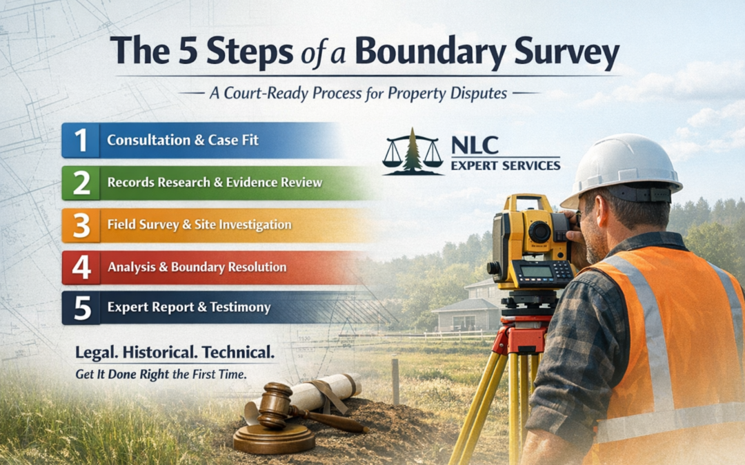
A field survey is a systematic and organized data collection method used in various fields such as geography, environmental science, urban planning, agriculture, and market research. Its primary purpose is to gather information, observations, and data collection directly from the natural environment or a specific location. Field surveys involve sending researchers or surveyors to the field, typically outdoors, to collect firsthand information and data.
Field surveys can take on various forms, including:
· Environmental Surveys: These involve collecting data about ecosystems, wildlife, or natural resources to assess their health and condition.
· Geographical Surveys: These focus on mapping and gathering geographic data, such as landforms, terrain, and physical features.
Field surveys typically employ tools like questionnaires, GPS devices, cameras, and environmental sensors. Researchers must carefully plan and execute field surveys to ensure accurate and reliable data collection, making them a crucial component of scientific field research, decision-making, and planning processes across various disciplines.
Types of Property Records
Before conducting a field survey, thorough research of property records is essential. This pre-survey phase involves examining official documents, deeds, and land titles to gain insights into the property’s history, boundaries, and legal status. Property records can reveal ownership history, past transactions, and any existing encumbrances, such as liens or easements. This information is crucial for survey planning, ensuring accurate boundary determinations, and compliance with zoning regulations. Additionally, property records help identify potential issues or discrepancies that may need resolution before the survey begins. By conducting comprehensive property record research, surveyors can streamline their fieldwork and deliver precise, reliable results. The records below are the most common records a surveyor expert witness may encounter in the survey process:
- Deeds and Title Records
Deeds and title records are foundational documents in land ownership and transfer. These records outline the legal history of ownership and transactions related to a specific property. Deeds typically include information about the property’s boundaries, dimensions, and any encumbrances or easements affecting the land. Title records, on the other hand, provide a chain of ownership, indicating who has owned the property over time. These records are essential for understanding property boundaries and potential legal issues that might impact the field survey.
- Plat Maps and Surveys
Plat maps, also known as cadastral maps, are detailed drawings that depict property boundaries, dimensions, and geographic features. These maps often accompany deeds and provide a visual representation of the land’s layout. Similarly, surveys conducted by licensed surveyors offer accurate measurement of property boundaries and other relevant features. Reviewing plat maps and surveys from various periods can help researchers identify changes in land use, property divisions, and potential discrepancies over time.
- Zoning and Land Use Records
Zoning and land use records are crucial for understanding how a specific area is regulated and designated for various purposes. Municipalities establish zoning codes that determine allowable land uses, building setbacks, height restrictions, and other survey protocols . These records inform surveyors about the legal constraints and potential uses of the land, guiding the survey’s focus and design. Identifying zoning changes over time can reveal shifts in urban development and help assess potential impacts on the survey area.
- Historical Aerial Imagery
Historical aerial imagery provides a visual record of the survey area’s evolution over time. These images, captured by aerial photography or satellite imaging, offer insights into changes in vegetation, land use patterns, and infrastructure development. By comparing historical imagery with present conditions, surveyors can identify alterations in topography, land cover, and drainage patterns that might influence the survey’s results. Historical aerial imagery is particularly valuable for detecting long-term changes that might not be evident through other records.
- Tax Assessment Records
Tax assessment records provide information about property values, ownership, and tax payments. These records are maintained by local government agencies and can offer insights into changes in property ownership and land use over time. Tax assessment records may also include details about property improvements, such as buildings, fences, or other structures. Surveyors can use this information to assess the impact of such improvements on the survey area and understand the context in which they were constructed.
- Historic Land Use Documents
Historic land use documents, such as land grants, land patents, and homestead records, offer glimpses into the early history of the survey area. These records often reveal the original purpose for which the land was granted or settled. Researchers can uncover information about the area’s initial use, such as agricultural activities or mining operations, which can provide insights into potential soil contamination or artifacts of historical significance.
- Environmental and Geological Reports
Environmental and geological reports provide information about the natural characteristics of the survey area, including soil composition, hydrology, and potential hazards. These reports often document soil types, drainage patterns, and geological formations that could impact the survey’s feasibility or results. Additionally, environmental reports may indicate the presence of contaminants or other hazardous materials, ensuring that surveyors take appropriate safety precautions during fieldwork.
- Historic Newspaper Archives
Historic newspaper archives can provide valuable context and information about significant events, developments, and changes in the survey area over time. Articles related to property transactions, infrastructure projects, and community events can shed light on the area’s historical context and aid in interpreting other land and property records. These archives may also contain advertisements, public notices, and maps that offer insights into local perspectives and perceptions.
Challenges
Before the advent of modern land surveying techniques, conducting records research posed a multitude of challenges. Land surveying is essential for establishing property boundaries, resolving disputes, and ensuring proper land use planning. However, various obstacles make records research a complex and time-consuming endeavor. Some of the key challenges that exist include:
1. Inaccurate and Incomplete Records: One of the primary challenges was the lack of accurate and complete land records. Many early land records were handwritten, prone to errors, and difficult to decipher due to fading ink or poor penmanship. This made it challenging to establish clear property boundaries or determine land ownership.
2. Missing Documentation: Records research often encountered difficulties due to missing or lost documentation. Over time, records were damaged, destroyed, or misplaced, leaving significant gaps in historical land records. This made it challenging to trace the history of land ownership and boundaries.
3. Changing Land Ownership: Land ownership frequently changed hands through various means, such as inheritance, sales, or land grants. Tracking these transitions was a challenge, especially when records were poorly maintained or not updated promptly.
4. Legal Disputes and Boundary Conflicts: Land disputes and boundary conflicts were common, leading to lengthy legal battles. Without accurate and detailed survey data collection, resolving these disputes was a time-consuming and expensive process.
5. Limited Technology: Before the advent of modern surveying equipment, surveyors relied on rudimentary tools like chains, compasses, and theodolites. These tools were less accurate and required significant expertise, making the surveying process slow and prone to errors.
6. Poorly Defined Boundaries: Some areas lacked well-defined boundaries, particularly in remote or uncharted regions. Surveying these areas required extensive fieldwork and often resulted in disputes due to unclear boundary lines.
Leveraging Technology
In the realm of land surveying, the utilization of technology in records research has transformed the way professionals collect data and gather historical information. Before embarking on a land survey, comprehensive research of existing records is paramount to understanding property boundaries, rights, and potential challenges. This process has been revolutionized by the integration of advanced technology, leading to increased efficiency and accuracy.
Traditionally, records research involved hours of manual document perusal in dusty archives, courthouses, and local municipalities. However, the advent of digitization has revolutionized this process. Land surveyors now rely on digital databases, Geographic Information Systems (GIS), and online platforms to access a wealth of information with just a few clicks. This technology enables them to locate historical maps, deeds, land grants, and other pertinent documents, often dating back centuries, which are crucial for determining property boundaries and historical land use.
Furthermore, Geographic Information Systems (GIS) have emerged as an indispensable tool in records research. GIS allows surveyors to overlay historical maps, aerial imagery, and property boundaries onto a single digital platform, facilitating a comprehensive data analysis of land changes over time. This not only streamlines the research process but also enhances the accuracy of land surveying by providing a visual representation of past land configurations.
Additionally, advances in data analytics and machine learning have empowered land surveyors to extract valuable insights from historical records. Algorithms can now identify trends, anomalies, and patterns in property history, aiding in the identification of potential property disputes or encroachments before they become significant issues.
The integration of technology in records research before a land survey has significantly expedited the process and improved its accuracy. Digital databases, GIS, and data analytics tools have made historical records more accessible and interpretable than ever before. This transformation empowers land surveyors to make informed decisions, mitigate potential disputes, and ensure the accuracy of their surveys, ultimately benefiting property owners and land development projects alike. Embracing these technological advancements is essential for modern land surveying professionals.
Best Practices
Before conducting a land survey, thorough records research is essential to ensure accurate and legally compliant results. Here are some best practices to consider when engaging in records research:
1. Identify the Purpose: Clearly define the purpose of the land survey. Are performing a boundary survey, assessing land value, or conducting environmental assessments? Understanding the goal will help you conduct a successful survey.
2. Review Historical Records: Start by examining historical documents, including deeds, titles, and land grants. These records can provide valuable information about past land ownership and legal rights.
3. Property Tax Records: Analyze property tax records to determine the current ownership and tax history of the land. This will help you verify the accuracy of existing property lines.
4. Plat Maps and Surveys: Access plat maps and past survey records. These documents often contain detailed information about property boundaries and can serve as valuable references for your survey.
5. Zoning and Land Use Regulations: Investigate local zoning ordinances and land use regulations. This information is crucial for understanding how the land can be legally used and any restrictions that may affect the survey.
6. Easements and Right-of-Way Agreements: Identify any existing easements or right-of-way agreements that may impact the property boundaries or access rights. These legal documents can significantly affect survey outcomes.
7. Environmental Records: If the land has environmental concerns, review environmental records and reports to assess potential hazards or restrictions on land use.
8. Adjacent Property Research: Investigate records for adjacent properties, as they can influence the survey and may have shared boundaries or interests.
9. Field Inspection: Conduct a field inspection of the property to verify physical boundaries and gather field notes. Compare your findings with the records to identify any discrepancies.
10. Professional Expertise: Engage the services of a licensed land surveyor or attorney with expertise in land surveying and property law to interpret complex legal documents and ensure compliance with local regulations.
11. Continuous Updates: Stay informed about any changes in property records or regulations, as they can impact your survey. Regularly update your research to maintain accuracy.
12. Documentation: Keep meticulous records of your research findings and sources. Proper documentation is crucial for legal and professional purposes.
By following these best practices in records research, you can enhance the accuracy, legality, and reliability of your land survey. Thorough research ensures that property boundaries are established correctly and that your survey results will hold up in legal and real estate transactions.
As made clear in this article, a thorough search for land and property records is a crucial step in the preparation phase of a field survey. These records encompass a wide range of documents, each offering unique insights into the survey area’s historical, legal, and contextual aspects. Deeds, plat maps, zoning records, historical aerial imagery, tax assessment records, historic land use documents, environmental reports, geological reports, and historic newspaper archives all contribute to a comprehensive understanding of the survey area. By analyzing these records, surveyors and researchers can establish a solid foundation for their field work, ensuring accurate results, informed decision-making, and a deeper appreciation of the area’s history and significance.


0 Comments