
A land surveyor report is an essential document that provides a comprehensive analysis of a specific parcel of land. Prepared by a licensed land surveyor, this report is crucial in various contexts, including real estate transactions, construction projects, and land development. Whether this is for a residential or commercial property (including a construction project), it serves to establish legal boundaries, identify physical features, and assess potential issues that could affect the use and value of the property.
Here, we dive deeper into the essential elements of a Land Surveyor Expert Report and what you should look for when reviewing this type of property survey report in any litigated matter.
Essential Elements of Property Survey Report
The fundamental components that constitute a thorough land surveyor expert report includes:
- Title Page and Executive Summary
The title page is the front-facing component of the report, providing the document’s title, the name of the professional surveyor, the client’s name, and the date of completion. It may also include relevant reference numbers for internal and external tracking purposes.
An executive summary follows the title page, offering a brief but comprehensive overview of the findings, conclusions, and recommendations in the report. This section allows the reader, often a non-expert, to grasp the essential conclusions quickly without delving into the technical details. It is a crucial element for project managers, attorneys, or property owners who may require a general understanding of the survey’s outcome before examining the minutiae.
- Scope of Work
The scope of work section outlines the extent and limitations of the surveyor’s duties. It defines the specific purpose of the survey—whether it was commissioned to determine property boundaries, topographical details, construction layout, or resolve a dispute.
In this section, the registered professional land surveyor clarifies what is covered and what is not covered in the report, thus setting the boundaries of responsibility. It is essential for this part to be explicitly clear to avoid any misunderstanding that could lead to potential disputes or challenges to the report later on.
For example, if the survey was commissioned to resolve a boundary dispute, the scope would be limited to determining the precise boundary lines. If the survey also covers topography or environmental concerns, those additional parameters would need to be clearly defined as well.
- Methodology
One of the most critical parts of the expert report is the methodology section. This part explains the processes and techniques used by the professional land surveyor to arrive at the conclusions in the report. A clear and detailed methodology lends credibility to the findings and allows other professionals to understand and replicate the procedures if necessary.
This section typically describes the equipment used, such as GPS devices, total stations, or drones, as well as the specific surveying techniques employed, whether they involve traditional methods, like tape and compass, or more advanced technologies, such as laser scanning or photogrammetry.
Moreover, the methodology includes details about the standards followed during the survey, which may involve specific guidelines or regulations mandated by local laws or professional bodies such as the American Congress on Surveying and Mapping (ACSM) or the International Federation of Surveyors (FIG). Any deviations from these standards should also be documented and explained.
- Survey Data and Findings
At the heart of the report are the actual survey data and findings. This section presents the collected data and the results of the survey, often accompanied by diagrams, maps, and other visual aids to illustrate the physical attributes of the land.
The data section should be factual and impartial, documenting the information collected during the survey. Depending on the nature of the survey, this might include coordinates of boundary markers, distances between key points, elevations, and other geometric data that are crucial for accurate representation of the site.
The findings, on the other hand, involve an analysis and interpretation of the collected data. This may include identifying any discrepancies between existing land records (such as deeds or previous surveys) and the current measurements, highlighting any encroachments or physical barriers that affect property boundaries, or determining the suitability of the land for certain types of construction.
- Maps and Diagrams
Visual representation is a key component of any land surveyor report. Maps, diagrams, and sketches should be included to give a clear graphical illustration of the data presented. These images help readers—especially non-experts—to visualize the findings. Examples include:
- Boundary Maps: These show the precise boundary lines of the property in question.
- Topographic Maps: If the survey includes elevation data, topographic maps will show the terrain, including any slopes or natural features such as rivers, lakes, or vegetation.
- Site Plans: These are often used in construction or land development projects, showing the layout of planned buildings, roads, utilities, and other infrastructure relative to the land’s boundaries.
These maps should be accurate and created using standardized symbology, making them interpretable by other professionals in the field. Modern technology enables surveyors to generate highly accurate digital maps using geographic information systems (GIS) software or computer-aided design (CAD) tools.

- Legal Descriptions
One of the primary reasons a land surveyor’s report is commissioned is for the creation or verification of a legal description of a property. This section provides the precise legal language that defines the property in question. This description is essential for any legal transactions, such as property sales, disputes, or development contracts.
Legal descriptions often take the form of “metes and bounds” or rectangular surveys, depending on the local jurisdiction’s requirements. The metes and bounds system describes the boundaries of the land based on physical landmarks, while the rectangular system uses a grid-based approach with reference to a meridian.
Inaccurate or vague legal descriptions can lead to disputes, and thus, it is critical that this section be drafted with care and precision.
- Conclusion and Opinions/Recommendations
After presenting the data, analysis, and findings, the report should end with a clear conclusion. This section ties together the information provided and reaffirms the surveyor’s expert opinion on the matter at hand. It might summarize the validity of the boundaries, highlight any areas of concern, or verify that the land is suitable for the intended purpose (e.g., development or sale).
Additionally, the recommendations part of the report offers any advice or actions that should be taken based on the findings. For example, if boundary disputes were uncovered, the surveyor might recommend further legal action, or if there are physical encroachments, they may suggest removing structures or adjusting property lines.
- Appendices
Any supplementary information that supports the findings but would clutter the main body of the report should be included in an appendix. This may include copies of deeds, historical surveys, regulatory documents, photographs of boundary markers, or raw data from the survey equipment.
This section provides a repository of additional documentation that is often required for legal purposes but is kept separate from the core content for clarity and ease of reading.
- Certification and Signature
The certification and signature of the land surveyor signify that the report meets professional standards and that the surveyor takes responsibility for the accuracy and integrity of the information presented. This final section is crucial, especially in legal contexts, as it formalizes the expert’s findings.
Most certification sections also include the surveyor’s professional qualifications, license number, and any relevant regulatory compliance details.
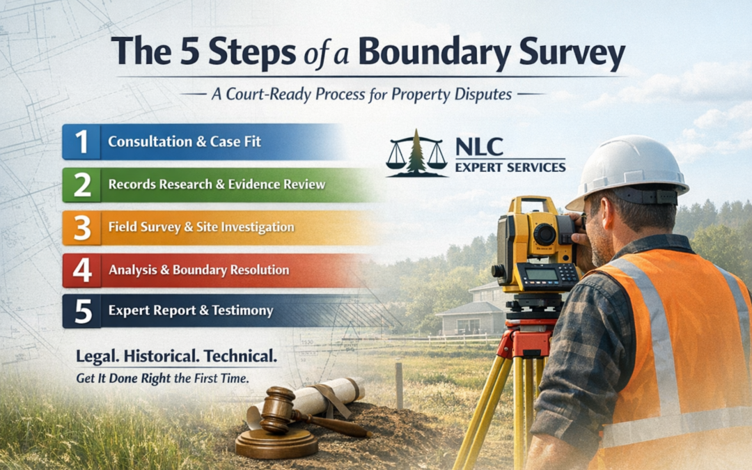
Depending on the project or property dispute, the survey type may vary. Here are a few different types of land surveys: ALTA survey, topographic survey, elevation certificate, subdivision survey, boundary survey, and more.
In summary, a registered land surveyor expert report is a technical, yet highly important document that requires precision, expertise, and transparency. By carefully crafting a report that includes a clear title page, scope of work, methodology, survey data, maps, legal descriptions, conclusions, and appendices, a land surveyor provides essential clarity and resolution for property owners, developers, and legal entities.
Contact NLC today for more information!


0 Comments