
Land Surveying is the art of marking boundaries based on the measurements, observations, and data collected through questionnaires. It involves a detailed study of the land to ensure it is a good investment. This article will learn about the three most important things we should know before scheduling a land survey.
1. Why Would You Need a Survey?
Before you hire an expert to study your land, you need to know the importance of land surveying. Here we have some significant reasons why people schedule land surveys.
- The most crucial reason for land surveying is to know the boundaries of the property you intend to purchase or sell.
- Moreover, you need to know about the property to meet mortgage requirements.
- Many people seek land surveyors to help settle land disputes.
- Before you plan to construct a building or a house, it is essential to know the boundaries that you can utilize for construction.
- People often schedule land surveys to update an existing property.
2. Types of Land Surveys
The next important thing you should know before seeking experts’ help is the type of survey you require for your land. Whether you need to split the parcel of the land or locate property lines, land surveyors provide all kinds of surveys depending on the requirement of the land.
Seven types of land surveys are as follows.
ALTA survey
People who wish to purchase a home or investment property require an ALTA survey. It stands for (American Land Title Association) survey. Moreover, another name for ALTA is the mortgage survey since leaders need it before offering to finance.
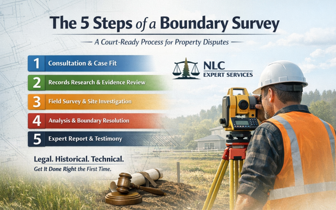
Boundary survey
A boundary survey settles boundary disputes as it helps determine the exact location of the boundaries and corners of a property. It also helps in locating easements or personal records.
Location survey
A location survey is similar to a boundary survey. However, it includes land improvements. Location surveys show the property’s exact location size of improvement and measure the distance between them and property lines.
Subdivision survey
It helps to divide the land into multiple divisions. Moreover, it helps in designing streets and drainages, and all the land records go in the recorders’ offices.
Site-planning survey
A site-planning survey helps in designing improvements before starting the construction. It includes subdivisions, housing lots, playgrounds, stores, streets, commercial and industrial sites, and highways. A site survey is essential while applying for building permits.
Construction survey
A construction survey includes staking out roads, walls, buildings, and other constructions located on a specific property. It helps the construction workers know where to build structures. It also includes horizontal and vertical grading alignments.
Topographic survey
Topographic survey shows natural and manufactured features located on a property. It includes buildings, utilities, fences, trees, rivers, ponds, and elevations. Engineers and architects use the topographic survey to plan site improvements.
3. How Much Does a Land Survey Cost?
The cost of surveying land depends on the size, shape, and type of the survey required for the land. It also includes the time needed for the land surveyor to reach the location. HomeAdvisor states that most land surveyors charge between $200 and $800. However, the cost may be higher for more significant properties.
The Bottom Line
Land surveying means a thorough study of the land that involves its measurement and history to make an informed decision. Banks do not approve loans without conducting a survey, as they must know where it is precisely investing.
Moreover, it is essential to research professionals before hiring them to survey your lands. Choose a company that knows its job and provides you with a timely report. Also, ensure that your land survey report is recent and shows all the information required to carry on the process.

0 Comments