
Of all the construction defect claims that land on an attorney’s desk, grading errors and site plan discrepancies are among the most technically difficult to prove. The physical evidence —the topography of the land before construction, the approved drainage plan, the deviation between what was permitted and what was built—requires a level of technical analysis that most attorneys and their clients are not equipped to perform on their own.
This is where a land surveyor expert witness becomes not just helpful but necessary. This article breaks down how grading errors and site plan discrepancies develop, how a surveying expert documents them, and what attorneys need to understand about using this evidence in construction defect litigation.
H2: What Is a Grading Error in Construction?
Grading refers to the process of shaping the land before and during construction to establish the correct elevations, slopes, and drainage patterns that a site plan requires. When grading is done correctly, water flows away from structures, drainage systems function as designed, and the finished improvements sit at the elevations the engineer specified.
When grading is done incorrectly, or when the contractor deviates from the approved grading plan, the consequences accumulate over time. Water that should flow toward a drainage swale instead pools against a foundation. A retaining wall built at the wrong elevation fails to hold back the grade it was designed for. A parking lot drains toward the building instead of away from it. These problems often don’t become visible until months or years after construction is complete, by which time the original conditions have been partially or fully obscured.
The three most common grading defects that produce construction litigation are:
Improper slope. The approved grading plan specifies minimum slope percentages to direct surface water away from structures. When a contractor flattens the grade to speed up work or reduce costs, water that should drain away instead accumulates. A land surveyor can compare the current topography to the approved plan and document the deviation with precision.
Incorrect finished floor elevations. When a structure is built at an elevation lower than the approved plan specified, the surrounding grade can drain toward it rather than away. This is particularly common in residential subdivisions where individual lots are built by different subcontractors working from a master grading plan without adequate coordination.
Drainage infrastructure built in the wrong location. Swales, detention basins, inlets, and drainage pipes installed at incorrect elevations or in incorrect locations relative to the approved plan fail to function as designed. A surveyor can establish the as-built location and elevation of these features and compare them to the permitted design.
H2: What Is a Site Plan Discrepancy?
A site plan is the approved document that governs exactly how a construction project is positioned on a parcel of land. It specifies building setbacks from property lines, the location of driveways and parking areas, the placement of utilities and easements, finished floor elevations, and the boundaries within which all improvements must fall.
When what gets built doesn’t match what the site plan required, whether because of contractor error, design change, or miscommunication between trades, the result is a site plan discrepancy. Depending on the nature and severity of the discrepancy, the consequences range from permit violations and required demolition to encroachments onto neighboring properties and violations of recorded easements.
Common site plan discrepancies that produce litigation include:
Setback violations. A structure built closer to a property line than the approved plan and applicable zoning code permit. These are often discovered during a subsequent survey, sometimes when a neighboring property is being sold, and a new survey reveals that the improvement is partially over the property line.
Improvement location errors. A building, parking structure, retaining wall, or utility installation placed at the wrong location on the site relative to the approved plan. The deviation may be measured in feet or in inches, but in densely developed areas even small deviations can trigger encroachment claims, easement violations, and required remediation.
Easement violations. Construction that occurs within a recorded utility easement, drainage easement, or access easement. The surveyor’s role is to establish the exact location of the easement relative to the improvements that were built within or over it.
H2: How a Land Surveyor Documents These Defects
The evidentiary value of a surveyor’s work in a grading or site plan case depends entirely on the quality of the methodology. Courts and opposing experts will scrutinize every step of the process, from how the survey was controlled, to what reference points were used, to how the findings were reported.
Tony Nettleman’s approach to documenting grading errors and site plan discrepancies in litigation follows a structured methodology:
Step 1 — Establish the record baseline.
Before any fieldwork, the surveyor reviews the complete record of the project, the approved site plan, the original topographic survey, the grading plan, the as-built survey if one exists, the permits, and any inspection records from the building department. The record baseline is what the contractor was required to build. Everything in the field investigation is measured against it.
Step 2 — Conduct the field investigation.
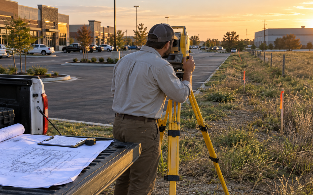
The surveyor goes to the site and takes precise measurements of current conditions, the actual elevations, the actual locations of improvements, and the actual drainage patterns. This work is performed using survey-grade equipment and documented with field notes, photographs, and, in complex cases, drone or LiDAR data to capture the full three-dimensional topography of the site.
Step 3 — Prepare the comparison analysis.
The surveyor overlays the current field conditions on the approved site plan and grading plan to produce a direct comparison: what was required versus what was built, measured with survey-level precision. This comparison is the technical core of the expert report and the foundation of the testimony.
Step 4 — Translate the findings for the court.
A grading plan deviation measured in tenths of a foot means nothing to a jury without context. The surveyor’s job is to explain what that deviation caused, why the water went where it went, why the foundation experienced the moisture intrusion it did, why the drainage infrastructure failed, in language a non-technical fact-finder can understand and apply to the question of liability.
H2: Why the Methodology Matters — Daubert in Construction Defect Cases
In federal court and in states that have adopted the Daubert standard, the court evaluates expert testimony before it reaches the jury. The judge asks whether the expert’s methodology is reliable, whether it has been tested, whether it is generally accepted in the relevant professional community, and whether the expert applied it correctly to the facts of the case.
For land surveyor expert witnesses in construction defect cases, the methodology question centers on survey standards, specifically whether the surveyor followed the standards of practice required by their state licensing board and by the professional standards that govern surveying work in litigation contexts.
Tony Nettleman co-authored the three primary texts that define those standards: Clark on Surveying and Boundaries, Brown’s Boundary Control and Legal Principles, and Evidence and Procedures for Boundary Location. When opposing counsel challenges his methodology under Daubert, they are challenging the methodology of the person who helped write the standard. That record has never produced a successful exclusion in over twenty years of expert witness practice.
H2: What Attorneys Get Wrong About Grading and Site Plan Cases
Several patterns consistently appear in construction defect cases involving grading and site plan issues where the surveying component was not handled correctly:
Relying on the contractor’s as-built survey. Contractors are required to provide as-built surveys at project closeout, but those surveys are prepared by surveyors the contractor hired. In litigation, the independence and completeness of the contractor’s as-built survey is frequently a contested issue. An independent survey by a retained expert provides the neutral, defensible documentation that the contractor’s as-built cannot.
Waiting too long to inspect the site. Grading conditions change. Landscaping gets installed. Drainage is modified. Evidence of the original defect gets covered, altered, or lost. In grading defect cases especially, the earlier the expert gets to the site, the stronger the evidentiary record.
Not identifying the responsible party precisely enough. A grading error may be the responsibility of the general contractor, the grading subcontractor, the civil engineer who produced the plan, the soils engineer whose recommendations were ignored, or some combination of all of them. A thorough surveying investigation helps attorneys identify with precision whose work deviated from the approved plan and when, which directly affects who gets named and what the damages theory looks like.
CONCLUSION:
Grading errors and site plan discrepancies are provable claims, but proving them requires the right expert doing the right work at the right time. A land surveyor expert witness with the credentials, methodology, and communication skills to bring these issues to life for a court is a significant advantage in construction defect litigation.
Tony Nettleman is available for consultation on construction defect cases involving grading errors, site plan discrepancies, encroachments, and related surveying issues. Contact Nettleman Land Consultants at cnettleman.net to discuss your case.
Need a Court-Ready Boundary Survey Process?
If you are already involved in a property dispute or litigation is likely, starting with a structured, expert-led process matters.
NLC Expert Services begins with a free consultation to determine fit and recommend the correct next step.
Take the Quiz to see if you need an Expert Surveyor

0 Comments